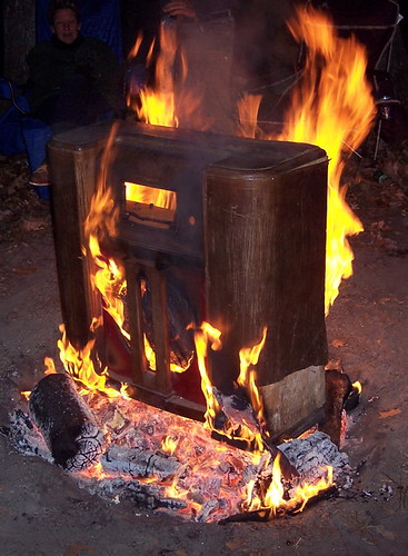
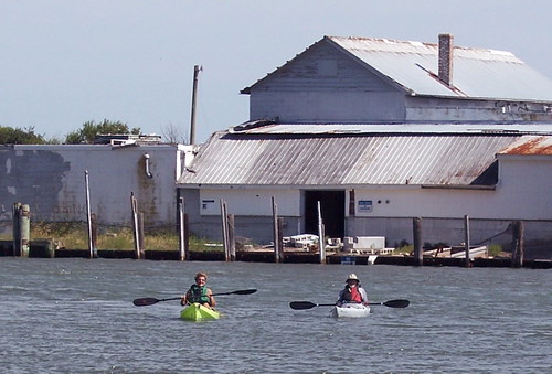
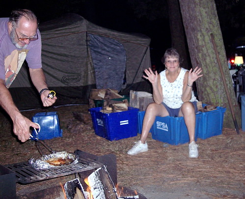
When you see burning furniture, you know it is Fall Follies time! It isn't a paddle, but many Mice come to this annual event, held at Newport News Park the weekend before Thanksgiving. This is not roughing it, unless you call sleeping in a tent on an air mattress under an electric blanket roughing it!
The Follies has been a Mogul tradition for over ten years, and is usually the biggest camping event of the year. It is pretty much the final outdoor event before the holidays and ski season. It is also a great chance to relax and enjoy the comany of your fellow campers.
Tuesday, November 29, 2005
Fall Follies 2005
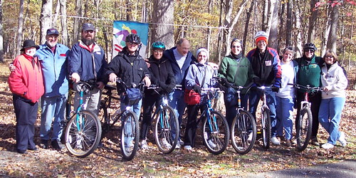
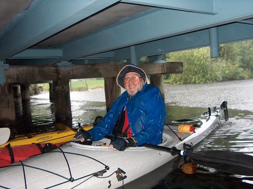
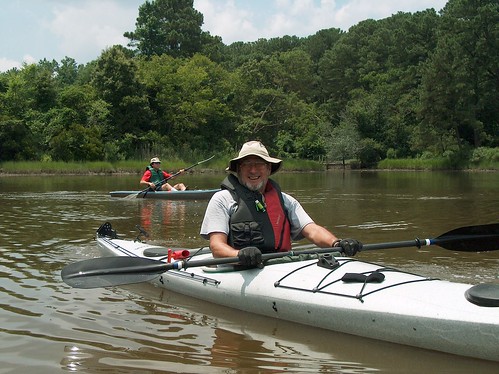
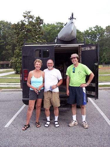
Ready for the Bike Ride
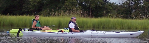
As this is a paddling blog, it probably should at least cover a group of people using their own physical power to travel a scenic route, even if it isn't on a kayak!
One of the highlights of the Fall Follies bike ride through Newport News Park, the Yorktown Battlefield National Park, and historic Yorktown. This is a very traditional ride, with several mandatory stops along the way. This time, the weather was perfect for the daring riders, including Jeff, Jim, Bobbie, Debbie, Chriis, Jim and Chris.
George Washington (blanked) Here
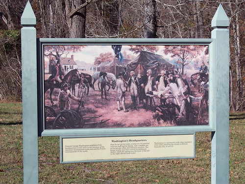
The first traditional stop on the Fall Follies bicycle ride is Washington's Headquarters, just inside the battlefield park.
Mogul historians have uncovered the truth about this spot. He didn't lead his army from here, but he did take care of some urgent "personal" business down at the creek behind this sign. Various Moguls have reenacted this momentous event throughout the years.
The group also makes it a point to stop on top of the bridge over route 17, and to NEVER follow Jim and Bobbie, except for this year. In addition to the traditional historical spots, Jim and Bobbie led some rapidly tiring cyclists to Yellowstone National Park this year on their way to Yorktown.
The Cornwallis Tree
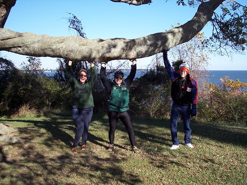
Legend has it that when the American and French troops had Lord Cornwallis surrounded at the end of the battle of Yorktown, he climbed this tree, and refused to come down until the troops apologized for calling him names.
Traditionally, Mogul has reenacted Cornwallis' fateful climb. Several riders would climb up and sit on the large limb until they were photographed. After years of such abuse, the limb now needs support, so Chris, Chris and Jim lend a hand with some historic preservation.
The Destination
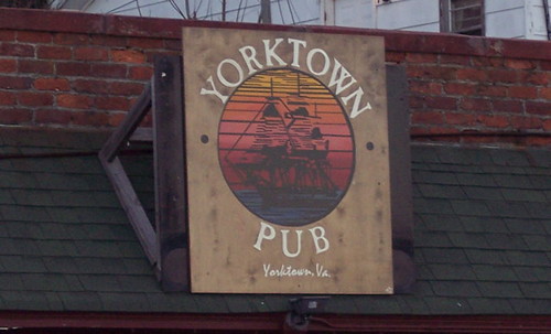
The Yorktown Pub has been around for a while, and is a cozy, neighborhood kind of place that happens to serve people from all over, including a certain campground on the other side of the battlefield. The pub is on the scenic Yorktown waterfront, in the shadow of the Coleman Bridge. The chowder comes highly recommended, as does the St. George Golden Ale, brewed up in Hampton.
This year, the group was joined by John, who ventured out just a couple of weeks after heart surgery. It was great to see him out and about!After a tasty lunch, most of the group trudges back up the steep hill to start the ride back to camp.
Seeing the Sights
Some folks decide to stay at the Pub until the big football games, like Michigan- Ohio State, are over. Then it is time to wander back along the route as it gets dark.
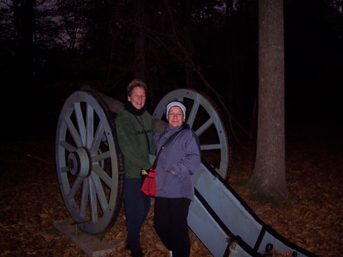
When one is confident in their ability to pedal back to the campsite at dusk after several beers, one stops to see some of the sights along the way. Here, Chris and Debbie check out George Washington's personal cannon. Yes, it really is that big!
It Wouldn't be Fall Follies Without...
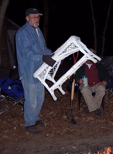
Jerry burning stuff. From radio cabinets to chairs, from wood to wicker, one of the highlights of Fall Follies is seeing what Jerry will add to the fire to make it burn brighter.
Thanks to Jeanine for organizing (and founding) the Fall Follies each year. One of the best events going!
END Fall Follies
Friday, November 04, 2005
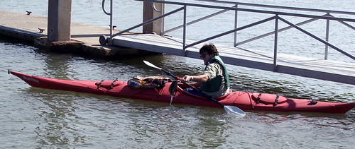
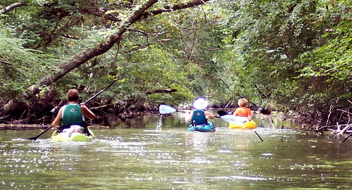
Put-in at Cherrystone Creek
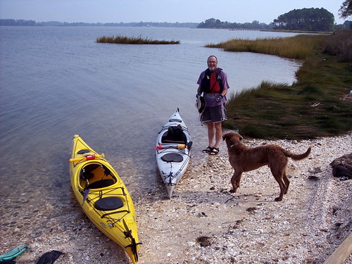
One of the benefits of a sit-inside kayak is that you can extend your season. Two mice did just that, venturing back to the Eastern Shore in late October for a paddle on Cherrystone Creek. Jerry and Jeff found this put in just upstream from the Cherrystone campground near Cape Charles.
It turned out to be a beautiful day for a paddle, with the temperature in the mid-60's, and very little wind. Looking at all of the open water, the lack of wind was a real blessing! A friendly dog even joined us, and found a good stick to fetch!
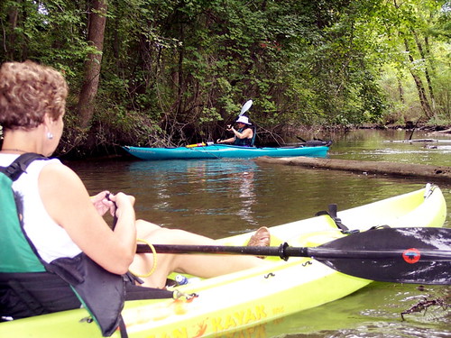
Follow the Creek Wherever It Goes
There are numerous small creeks that branch off of the very wide Cherrystone Creek. We wound up following Eyrehall Creek for quite a while. It started about 20 yards wide at a dock and boathouse, and wound up pretty close to US-13 at about 8 feet wide. As with many small creeks, there were a lot of twists and turns, so while you may have paddled a long way, you might not have wound up very far away.
This nice scene was about two-thirds of the way up Eyrehall Creek.
Any Place to Stretch Your Legs
One of the things abouit paddling is that you always want to stretch your legs, and your seat can get kind of sore. It isn't always easy to find a place to pull over, so when you see something, you go for it. Here, we found a very small sandbar. Not much room, but if all you want to do is stand up, what the heck!
This sandbar presented a unique hazard. In arriving, we scared off a couple of swans, and a large flock of terns, just hanging out on this small spit of land. When birds are just standing around, what do they do? Well, lets just say we watched our step on this particular sandbar!
END Cherrystone
Saturday, September 24, 2005
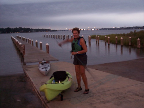
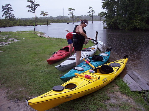
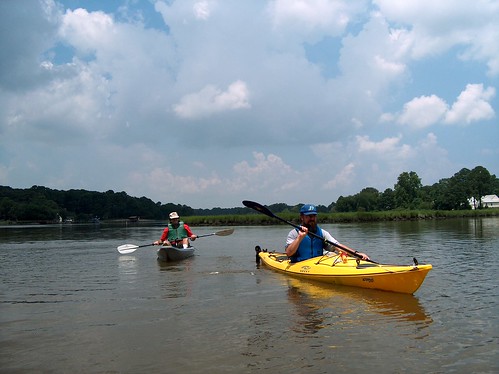
Getting Ready to Paddle the Last Leg!
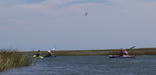
On September 24th, six Mice gathered at the Hutton Lane dock to paddle the last leg of the Virginia Beach Scenic Waterway. It was a five mile paddle on the Lynnhaven River, from Virginia Beach Boulevard to the Lesner Bridge.
Jeanine, Jim and Jeff aren't pictured, but were joined by Jerry, Chris, and Louise, getting ready to go. Louise was with us for the first time, and got to witness a time-worn ritual. It seems that Jerry and Chris can't get in their boats without a hug beforehand.
A qick peek behind them, and you can see it was high tide. We planned to use the tide to help take us north. With the wind out of the northeast, we needed the help!
See You at the Take Out!
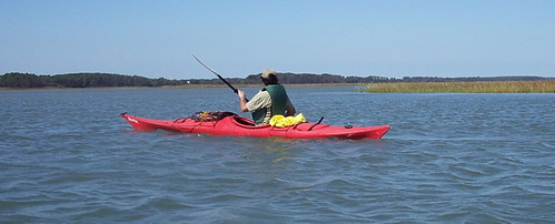
Chris was in the mood to paddle this day, despite the stiff breeze and overcast skies. it looked like it could rain, but it never did while we were out on the water. The wind was about 15 miles per hour, barely a breeze to those who paddled Kiptopeke two weeks before!
Was Chris saying "see you at the take out?" Maybe. She and Jeanine pulled ahead of the rest of the group, and got to Bubbas in time to step inside for a moment before greeting everyone else!
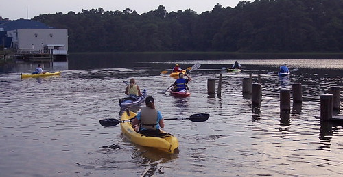
How Many Birds Do You See?
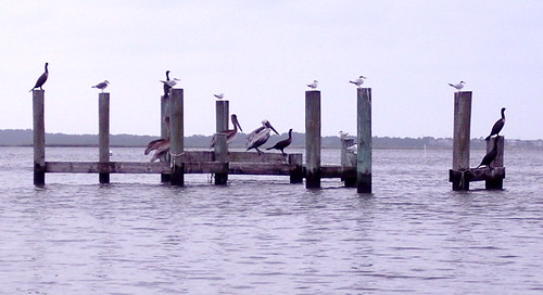
There's always plenty of wildlife on a River Mice paddle. How many different birds do you see in this picture?
Seven terns, five cormorants, three pelicans and a gull are hanging out on this piece of dock. The terns were busy during most of our paddle diving form 30 feet up into the water for fish. the pelicans and cormorants seemed content to hang out and relax in the wind.
Lured to Bubbas
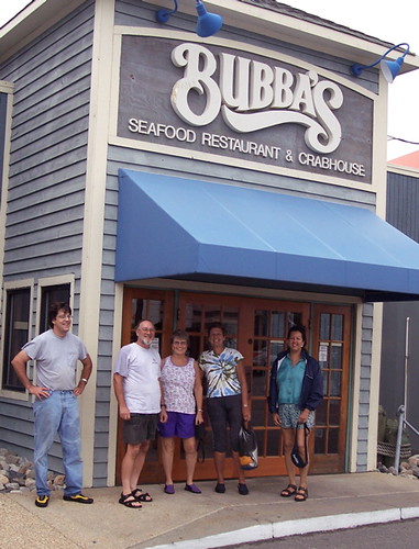
Jerry commented that there were magnets in the boats that lured us to Bubbas. He was right! It is so convenient to pull up on the boat ramp, get the boats off to the side, then head inside for a snack. Well, in this case, it was dinner and a cold refereshing beverage on the deck.
Looking out over the water, we saw dolphins playing, just fifteen minutes after we paddled through. We looked for them when we made the quick trip across Lynnhaven Inlet to the take-out, but they had gone back into the bay with the tide. As it was, we got back just before it got dark.
And thus ended our trip through the Virginia Beach Scenic Waterway. Chris, Jim and Jeff made it for all four paddles, from Munden Point in the south, over four different days, to the Lesner Bridge in the north.
END LYNNHAVEN RIVER PADDLE
Tuesday, September 13, 2005
Kiptopeke 2005
To many of the River Mice, the Kiptopeke weekend is the highlight of the paddling season. To others, it is a sign that summer is nearly over. To all who go, it is a great time.
Kiptopeke State Park is located about three miles north of the toll plaza for the Chesapeake Bay Bridge Tunnel on the Eastern Shore. It is only 40 miles from downtown Norfolk, but it seems a world away. It makes for a very mellow weekend, remembered by all.
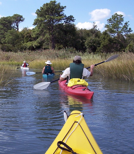
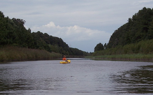
Of course, the main reason to go was to paddle, and paddle we did. This is one of our few chances to paddle the open water near the ocean. Generally one of the barrier islands along the Atlantic is our destination. In this picture, the group heads out from Oyster to Mockhorn and Ramshorn Bays.
Jim Handles the Chop
Heading out from Oyster harbor, we were sure to paddle against the wind. This way, once we were tired, the wind would help us back to the put-in.
Where the water was more open, and the wind had a bit of reach, things got a little choppy. We met waves up to a foot and a half in height. It was tough keeping your balance when your bow would go out of the water and get blown a foot to the right.
Jim is shown paddling in calmer water- still choppy, but easier to navigate.
Back to Oyster
After 30 minutes of "coasting" in on the wind and waves, we finally entered Oyster Harbor. With judicious use of the rudder, and only an occasional stroke, we could relax all the way back to the dock!
Here, Chris and Jerry demonstrate their technique. Jerry sat as you see him all the way to the dock!
Jim Rescues His Hat
After the paddle, we sat on the dock for a late and hard earned lunch. We talked about the paddle, and the upcomimg night at the campsite.
Suddenly a gust of wind came along and blew Jim's hat in the water. Everyone thought it would blow on the surface to the other dock, but halfway across, it began to sink. Jim had to hop in his boat and paddle over to it. Of course, the moment was photo-worthy!
The Paddlers at Oyster Harbor
Jeff, Jeanine, Jim and Jerry pose after the paddle at Oyster. Chris, perhaps lamenting the fact she didn't have a "J" in her name, stayed behind the camera and snapped the picture.
Monday, September 12, 2005
The Gang at Kiptopeke
Part of the group enjoys the sunset at the beach. Chris and Jeanine, along with Jerry, Jim and Jeff arrived Friday. They were joined Saturday by Betsy, Dennis, Ann and Bob.
Hands Off the Fire!
Our Kiptopeke outing combines great paddling with some good old campfire comraderie. Jerry is tending to dinner, while Jeanine finds a comfortable seat to observe. Well, comfort is relative, and possibly a function of how much wine one has had!
As usual, Jerry provided plenty of firewood, and the food was delicious and as plentiful as the firewood.
Follow the Leader!
We really felt like paddling on Sunday, but our first choice was out of the question. We wanted to paddle around the concrete ships at the breakwater, but the wind was too strong, and blowing the wrong way.
So we went to our old put-in at the wildlife preserve, but instead of heading out to Raccoon Island, we stayed close to shore, and paddled the meandering creeks and pathways of the wildlife preserve. Our goal was the trees in the distance, but there was not a straight line to get there!
A Relaxing Sunday Paddle
This weekend, there were two ways to paddle- with the wind, or against the wind. There was very little in between.
Against the wind, you had to work. Among the reeds, with the wind blocked, it wasn't too bad. In the open, on the main channel, it took about 5 minutes to go 100 yards in what seemed like a howling gale.
Of course with the wind, things were much easier. Here, Jeanine enjoys a wind-aided stretch, using nothing but rudder to steer her way down the creek. A nice way to travel, especially if you have earned it!
Lost in the Reeds
Sunday's paddle didn't take us very far from the put-in, but far enough that we found ourselves in some interesting situations.
Jeff nevigated the group into a dead end with no turning space. So it was paddle backwards, or press on through the reeds. Ultimately, Jerry was able to find the way back to the creek, but not before doing the paddling equivalent of poling across a flat expanse of snow. Through the reeds, and the bugs, and more reeds, in foot deep water.
I Told You Those Kiptopeke Sunsets Were Good!
What a great weekend! The brilliant sunsets were symbolic o f the great time we had. Aside from the wind, the weather was perfect for paddling and camping. Of course, being with friends was the best part of the weekend.
We will be back next year- hope you can join us! Mark your calendar for the weekend after Labor Day.
END OF KIPTOPEKE
Tuesday, September 06, 2005
Down the Creek
On August 27th, five Mice took a trip down the creek, with paddles. Jim, Jeanine, Jeff, Chris, and new member Jean met at the Princess Anne Road dock, set a shuttle, then headed down the creek.
A few wrong turns later, the group finally found the right trail. Sometimes Jeff gets his right and left confused. (He flunked left/right in Kindergarden!)
The paddle started with the narrow creek, and trees leaning over the top of us. Later, the paddle moved into wider waters, before we finally took out at the Hutton Lane dock off Virginia Beach Boulevard near the Pep Boys.
It was hard to believe that with scenery like this, we were paddling through the suburban heart of Virginia Beach!
Sometimes You Just Blast Through
The word for the day was "logjam". The group encountered plenty of them along the way. Some were easy to solve, we just had to push the logs and downed trees out of the way.
Some were more difficult. If we couldn't pick our way through, the option of choice was to just get up a head of steam and try to ride up over the log. Here, Jeanine tries the technique with Chris observing.
This is an Industrial Park?
The last part of our paddle took us down a very wide London Bridge Creek from Shipps Corner Road to Virginia Beach Boulevard. you wouldn't know it, but we were paddling through the Oceana Industrial Park. You know, all of those buildings set between Lynnhaven Mall and NAS Oceana?
We got to see the fish scurry away from us, and the herons watched us from the trees. As you can tell, this stretch is long and straight. The only signs of civilization are the International Parkway bridge, and the jets at Oceana.
Winners of the Immunity Challenge
And it was a tough one! Counting the wrong turns, we paddled close to nine miles, and some of it was very slow going. No immunity icons, but it was worth it to see the scenery on this very unique paddle! The workout was an added bonus...
The last stage of the scenic waterway is scheduled for September 24th. Join us as we paddle from Virginia Beach Boulevard to the Lesner Bridge!
Sunday, August 21, 2005
Virginia Beach Scenic Waterway
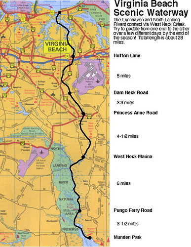
In case you have wondered what all the jibber-jabber is about the Virginia Beach Scenic Waterway, here it is in map form.
We did the first leg from Munden Park to the West Neck Marina on June 26th. It was a ten mile paddle!
The second leg was done backwards, from Princess Anne Road to West Neck Marina on July 31st. A short 4-1/2 mile paddle, but the rain and scenery made it interesting.
Next up, we will paddle from Princess Anne Road to the Hutton Lane dock behind the Pep Boys on Virginia Beach Boulevard. Saturday, August 27th is the date.
Finally, we will paddle from Hutton Lane to the Lesner Bridge on September 24th. Come and join us!
Tuesday, August 16, 2005
City Park- To the Put-in
August's evening paddle was August 16th at City Park in Portsmouth- the perfect place to put in for the Western Branch of the Elizabeth River. Jerry, Jim, Chris and Jeff met at 6pm for a nice, relaxed paddle across the river and up one of the many creeks in Portsmouth and Chesapeake.
Here, Jim is wheeling his boat to the sailboat ramp at City Park, about 150 yards from the powerboat ramp. The Sterling Point neighborhood is across the river.
Ready for the Western Branch
The kayaks are ready to go, and Jerry is setting his GPS to record how far and how long we paddle. Things just seem to be more relaxed, yet more vivid at the end of the day, which is one big reason we do evening paddles. We usually don't paddle too far or too hard, and just try to enjoy the scenery we go by and the wildlife that is just coming out after the heat of the day. it can be a little hectic trying to beat the tunnel traffic after work, but once you are on the water, everything else just evaporates.
Paddling Down Stearns Creek
Stearns Creek runs between Portsmouth and Chesapeake, and winds through wetlands and backyards. Lots of nature here, as the neighborhoods are well established, with plenty of trees for the birds. The jellyfish were in abundance, too, in the warm creek water.
Chris and Jerry take a very short break from paddling, before realizing that it is time to turn back!
Back Just in Time
Things got worse pretty quickly, and the group paddled as quickly as they could back to City Park. We made it just in time, as dusk was about 20 minutes early, and the storms were about 2 miles away. We got the kayaks loaded and left the park just as the police started their sweep and the skies opened up. In all, we did 3.75 miles in an hour and a half- not bad for after work!
Sunday, August 14, 2005
Port Norfolk Put-in
Jerry and Jeff tried a new put in on August 11th. Located on Bayview Boulevard at the foot of Chautauqua and Mt. Vernon Avenues, this tiny stretch of beach allows access to the Western Branch of the Elizabeth River just west of the Portsmouth International Terminal. Wherever you go, you have to pass under the new Pinners Point Bridge, which keeps the parking area free of traffic.
Heading west, you can paddle towards Portsmouth City Park, and the Western Branch area of Chesapeake. Lots of great backyards, with a rest stop at City Park, and beverages available at the golf course pro shop.
Heading east, you paddle by the terminal, and the huge container ships loading and unloading there. Stay at least a hundred feet away from the ships, if not more, both because of security, and because of the strange waves that can reflect off the ship hulls.
The semi-open water of the Elizabeth is next. turning south, you can see downtown Norfolk, and a little closer, the Naval Hospital. Turn right just before the hospital, and the calmer waters of Scotts Creek allow a half hour of exploring.
It helps to feel secure in small waves and swells here, as the wind and wakes can combine for some interesting water!
Tuesday, August 02, 2005
West Neck Creek- 7/31/05
This was the second leg of our tour of the Virginia Beach Scenic Waterway, Covering West Neck Creek from the West Neck Marina south of Pungo to Doziers Bridge on Princess Anne Road near the Virginia Beach Municipal Center. We actually went backwards, from north to south. We intend to have covered the entire waterway, from Munden park to the Lesner Bridge, before the end of the season.
There is a nice dock at the Dozier's Bridge site- a great place to put in. Parking is available, but pay close attention to the no parking signs. One of the Beach's finest drove down to the dock hoping to write a parking ticket or two. Instead, all he could do was wave.
Oh, and Jeanine was helping Jerry find his paddle!
Taking Cover!
Ten minutes into our paddle, it started to rain. Just when we thought it would let up, it rained harder. Just when we thouight it couldn't keep up anymore, it really started pouring! You can see what we were dealing with in the background.
About halfway through the paddle, at the 1:15 mark, we were able to take cover under the Indian River Road bridge for a break from the elements. Those with glasses wiped them off, and those with beverages opened them. Those of us with bailers also bailed our boats of about an inch of accumulated water inside.
Between Princess Anne and Indian River Roads, the paddle goes through a tree-lined channel. Thankfully, someone had been through with a chainsaw sometime after hurricane Isabel, because there were few obstacles. If you have a rudder, you have to take it up every once in a while as you paddle over large floating logs. Chris and Jeanine did a great job of "clearing the way" for Jerry, Jim and Jeff!
A Wet Take Out
You can see how it was still raining at the end of our paddle, but you can see some of the awesome scenery that we went through. It looked great even despite the rain.
We took out at the West Neck Marina's boat ramp, just off of West Neck road in southern Virginia Beach. It cost $2 apeice to park two vehicles at the marina for shuttles. Setting a shuttle is mandatory for one-way paddles, so the paddlers and boats can reunite with their vehicles. We often prefer to carry our boats back to the put-in with our shuttles, so it is important to park vehicles that can carry multiple kayaks.
Too Little Too Late
After 3 hours in the pouring rain, Jerry remembered he had an umbrella, and brought it out to protect his soaked self from the drizzle that persisted at the end of the paddle. The drizzle wasn't going to keep us from a little picnic, not after what we'd been through!
All of our paddles are interesting and fun, some more so than others. This paddle was no exception. As long as you didn't mind getting a little wet, this was an awesome paddle!
Monday, July 25, 2005
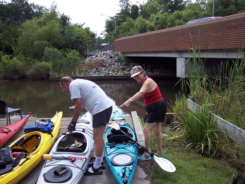
So You Want to Buy a Boat
If you have been out with us, you have seen a few different types of boats. The three types that most Mice paddle are recreational, sit-on-top, and touring.
Sit on tops are easy to pick out of a crowd. There is no cockpit, just a molded seat that you sit in and on. Hopefully, there are holes in the bottom of the boat, making it self bailing. A good sit on top for the type of paddling we do is the Ocean Kayak Scrambler or Scrambler XT. It is rock solid stable, and tracks pretty well. (When a boat tracks well, it goes straight well.) Chris Hoyland has the lime-green Scrambler and loves it. There are other sit on tops around also. Sit on top boats are easy to get in and out of, and never need bailing. if you happen to fall out of one, just flip it back over and climb in! You may find yourself sitting in a little bit of water in your seat- no big deal, unless the water is cold! You are also more exposed to the elements, and may find your season shortened a little.
Recreational boats are basically entry level sit-in kayaks. They have a large cockpit and great stability, and are the least expensive of the sit-in boats. They are often light enough to carry by yourself, and very "user friendly." Bill Larson and Cheri Lewis both have recreational boats. If you don't want a huge investment, but want your own kayak, this may be the way to go. Just remember that the longer the boat, the easier it is to go straight.
Touring kayaks are made for paddling longer distances with ease. The cut through the water easier than the recreational boats or sit-on-tops. The cockpit is generally less roomy, and relatively tougher to get in and out of. Rudders are common, and really help with turning the boat, as most of these kayaks track quite straight. Jerry Schneider and Jeanine St. Romain have touring boats. The Perception Carolina is the most popular, and you will often see more than one at a River Mice paddle. For the paddling that we do, the only real disadvantages to the touring boats are slightly lower stability (still solid), slightly tougher ingress and egress, and expense. A Carolina will run you around $1000 when the bill is totaled.
WHERE TO BUY
Wild River Outfitters- Virginia Beach Boulevard and Rosemont.
http://www.wildriveroutfitters.com
Appamattox River Company- Oyster Point Road, Newport News
http://www.paddleva.com
Southeast Expeditions- Sunset Beach, eastern shore
http://www.sekayak.com
Cool and Eclectic Furniture- Shore Drive or Laskin Road, Virginia Beach
They sell Ocean Kayak sit-on-tops, believe it or not!
River Mice August Paddles
MOGUL RIVER MICE
AUGUST PADDLES
Sunday, July 31st (DATE CHANGE)
WEST NECK MARINA to PRINCESS ANNE ROAD
10am meet at the Princess Anne Road dock, about a mile east of the Municipal Center in Virginia Beach. We will set a shuttle and make this a one-way paddle.
This is the second leg of the Virginia Beach Scenic Waterway (of 4 legs). By the end of the season we hope to have paddled from Munden Park to the Lesner Bridge. This paddle starts out on a wide creek, then enters a narrow tree-lined channel. If you want to feel isolated, this is the paddle for you. This paddle is about six miles long, so it will be a challenge best met by non-beginners.
Saturday, August 6th
Lafayette River, Norfolk- PARTY AT JOHN SCHONK’S PLACE
Bring your boat to John’s house, which is right on the river. Make a short paddle or two to explore the various creeks that branch off the river, and enjoy a Mogul summer party in the process. Jerry will be bringing his "contraption" to help us get in and out of the water if we need it.
Tuesday, August 16th
PORTSMOUTH CITY PARK EVENING PADDLE
6:00pm
This was one of our best paddles last summer. Put in on the Western Branch of the Elizabeth River for a relaxing paddle along the backyards of Portsmouth and Chesapeake. Plenty of wildlife, too!
Put in is at Portsmouth City Park. Take the Victory Boulevard exit of I-264, turn north towards the shopping center, and continue up to Portsmouth Boulevard. Turn left, and go for about a mile to the light at City Park Avenue. Turn right, and follow it into the park. Pass the golf course clubhouse on the left, and look for us on the right at the small craft ramp. If you get to the boat ramp, you’ve gone too far.
This is a beginner-intermediate paddle. It has an easy pace, but the open water of the Western Branch could be just a wee bit intimidating to a first-timer.
Saturday, August 27th
PRINCESS ANNE ROAD TO VIRGINIA BEACH BOULEVARD
11:00am
Join us for the third leg of the Virginia Beach Scenic Waterway- West Neck Creek through the heart of the Beach. We will put in at the city dock near the Municipal Center, and paddle around Oceana to the city dock on Virginia Beach Boulevard behind the Pep Boys. We’re trying to do the whole waterway this season, and this is the one leg that we haven’t done even a part of. So come out to explore some new turf!
Put in is about a mile east of the Municipal Center on Princess Anne Road. It is at the bridge about half a mile east of Holland Road on the north side. We will need to set a shuttle, as this is a one-way paddle.
This is an intermediate paddle- about five miles worth. It would be best if you have been out with us once or twice before.
September 9-11
5th ANNUAL KIPTOPEKE CAMPING WEEKEND
Come join us at Kiptopeke State Park on the Eastern Shore for a weekend of campng and paddling and comraderie as only Mogul can do it. Kiptopeke is a great campground, and the sunsets on the Bay can’t be beat. It is only 40 miles from Downtown Norfolk, but it feels a world away. We will paddle around a barrier island, or some other great location along the shore, and may head out Sunday also.
There will be a few more paddles before the season runs out. Come join us!
As always, if you email Jeff ahead of time, we will wait for you. PFD’s (life vests) are mandatory, and a boat helps also. If you don’t have one, there are always a few rigs we can set you up with. Just let us know!
Email Jeff Harper at jmharper@cox.net for more info. Also check out the River Mice blog at http://mogulrivermice.blogspot.com .
Hope to see you on the water!
Tuesday, July 19, 2005
Owl's Creek Evening, 7-19-05
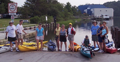
ELEVEN Mice came out after work on Tuesday the 19th to paddle Owl's Creek. This was the second evening/night paddle of the season, and we had a great time. Pictured are Jerry, John, Christie, Catherine, Jeanine, Jim's wife, Jim, Charlene, Chris, and already in his boat, Jim H.
The evening paddles are nice because things are a little quieter, and the wildlife seems to come out just before sunset. It is a great way to relax after a stressful day at work. The pace of these paddles is a little slower, and you have a chance to soak in everything around you. We will be doing one in August and September- stay tuned!
Off to Rudee Inlet!
It was high tide when eleven of us headed out towards the Rudee Inlet Bridge and the backyards of Croatan. In the foreground you can see Christie, showing good form after only being in a kayak for 5 minutes!
Beginners are welcome on many of our paddles. With enough notice, we can usually outfit you with a boat, paddle, and PFD so you can see what you have been missing. Owl's Creek is a good beginner spot because of the low (and slow) power boat traffic, and short distances to interesting places.
After the round trip to Croatan, we stopped at the Owl's Creek ramp for a break, and to see which direction some far-off lightning was going to go. Once we figured it would be safe to go back in the water, we set out again into the night...
Creature of the Night
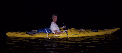
Yes, we were out at night! It can get a little creepy, since you have to navigate by shadows, and there are some strange creatures hanging around Owl's Creek. If you are very quiet, and a jet isn't flying overhead, you can hear fish, turtles, and who knows what else! John felt completely at ease on the water.
Look What I Caught!
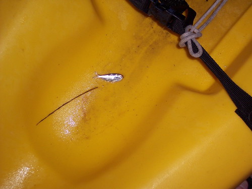
You may hear fellow mice talking about how the fish were jumping, and how some almost get inside the boats? This little fish got into a boat during the Owl's Creek paddle. How long before it grows to a foot long or more in the telling?
Monday, July 18, 2005
On the North Branch- Aftermath
After 2-1/2 hours and 4-1/2 miles of paddling, Jerry feels good, but looks a little spent. Dehydration is a big concern on these 90-90 days, so bring plenty of water with you!
It was a nice paddle at a new put-in. Hot, but we were able to catch enough breeze and clouds to cool off a little bit. We kept a wary eye on the clouds, but were able to stay safe, and away from the thunderstorms that drenched parts of the area.
This paddle was not scheduled. It was just a quick, last minute gathering set up on the Micemail list. If you feel like paddling, just send out an email. You never know what will happen!
On the North Branch- Jerry Before
Near the start of the paddle we were hydrated, happy, and looking forward to fun on the water. Just look at Jerry here, with a smile on his face and paddle at the ready. The fish were even happy to see us, as some big ones jumped out of the water in front of us.
On the North Branch
On July 16th, four Mice braved the heat and humidity and heat to paddle the North Branch of the Lafayette River. Jeff, Jerry, Jim and Chris put in at Lakewood Park in Norfolk, and paddled both ways along the river.
Saturday, June 25, 2005
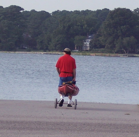
Jim's Rig
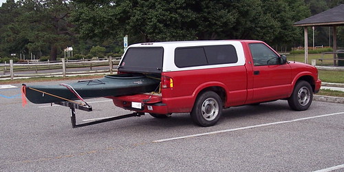
What do you do when your boat is a little too long? Adapt! That's what Jim did!
And be sure you are there for the next leg of the Virginia Beach Scenic Waterway, from the West Neck Marina to Princess Anne Road near the Civic Center. Get a look at Jim's unique rig first hand!
North Landing River- Needing to Rest
Ten miles in four and a half hours! The group stopped only at Captain Georges at Pungo Ferry for a lunch break. They battled the wakes from all of the powerboats and jet-skis, encountering two-foot waves at times. Turn into the wake as much as you can, and have fun riding the waves! And don't paddle too close to the osprey nests or mother will get angry!
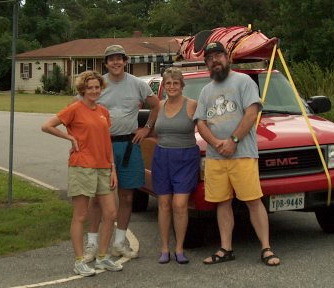
North Landing River- The Survivors
Four Mice put in at noon on June 26th to paddle the first leg of the Virginia Beach Scenic Waterway. It was the longest, and in many ways, the most challenging River Mice paddle yet. From Munden Park at the south end of Virginia Beach to the West Neck Marina, Jim, Jerry, Chris and Jeff paddled 10.2 miles through the summer heat.
Tuesday, June 21, 2005
Owl's Creek- Putting Our Boats to Bed
We put-in at 7:15, and took out at 9:40. After over two hours of paddling and a long day at work, it was time to head home. We loaded our boats and hit the road, but not before deciding that this paddle was worth repeating. So if you missed our Summer Solstice celebration, we will be doing it again in about a month- on or near the full moon in July.
Subscribe to:
Comments (Atom)
