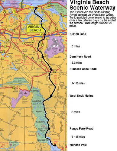
In case you have wondered what all the jibber-jabber is about the Virginia Beach Scenic Waterway, here it is in map form.
We did the first leg from Munden Park to the West Neck Marina on June 26th. It was a ten mile paddle!
The second leg was done backwards, from Princess Anne Road to West Neck Marina on July 31st. A short 4-1/2 mile paddle, but the rain and scenery made it interesting.
Next up, we will paddle from Princess Anne Road to the Hutton Lane dock behind the Pep Boys on Virginia Beach Boulevard. Saturday, August 27th is the date.
Finally, we will paddle from Hutton Lane to the Lesner Bridge on September 24th. Come and join us!
Sunday, August 21, 2005
Virginia Beach Scenic Waterway
Tuesday, August 16, 2005
City Park- To the Put-in
August's evening paddle was August 16th at City Park in Portsmouth- the perfect place to put in for the Western Branch of the Elizabeth River. Jerry, Jim, Chris and Jeff met at 6pm for a nice, relaxed paddle across the river and up one of the many creeks in Portsmouth and Chesapeake.
Here, Jim is wheeling his boat to the sailboat ramp at City Park, about 150 yards from the powerboat ramp. The Sterling Point neighborhood is across the river.
Ready for the Western Branch
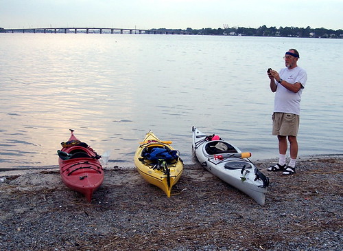
The kayaks are ready to go, and Jerry is setting his GPS to record how far and how long we paddle. Things just seem to be more relaxed, yet more vivid at the end of the day, which is one big reason we do evening paddles. We usually don't paddle too far or too hard, and just try to enjoy the scenery we go by and the wildlife that is just coming out after the heat of the day. it can be a little hectic trying to beat the tunnel traffic after work, but once you are on the water, everything else just evaporates.
Paddling Down Stearns Creek
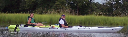
Stearns Creek runs between Portsmouth and Chesapeake, and winds through wetlands and backyards. Lots of nature here, as the neighborhoods are well established, with plenty of trees for the birds. The jellyfish were in abundance, too, in the warm creek water.
Chris and Jerry take a very short break from paddling, before realizing that it is time to turn back!
Back Just in Time
Things got worse pretty quickly, and the group paddled as quickly as they could back to City Park. We made it just in time, as dusk was about 20 minutes early, and the storms were about 2 miles away. We got the kayaks loaded and left the park just as the police started their sweep and the skies opened up. In all, we did 3.75 miles in an hour and a half- not bad for after work!
Sunday, August 14, 2005
Port Norfolk Put-in
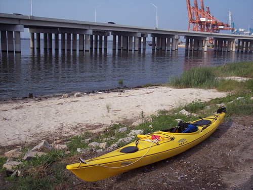
Jerry and Jeff tried a new put in on August 11th. Located on Bayview Boulevard at the foot of Chautauqua and Mt. Vernon Avenues, this tiny stretch of beach allows access to the Western Branch of the Elizabeth River just west of the Portsmouth International Terminal. Wherever you go, you have to pass under the new Pinners Point Bridge, which keeps the parking area free of traffic.
Heading west, you can paddle towards Portsmouth City Park, and the Western Branch area of Chesapeake. Lots of great backyards, with a rest stop at City Park, and beverages available at the golf course pro shop.
Heading east, you paddle by the terminal, and the huge container ships loading and unloading there. Stay at least a hundred feet away from the ships, if not more, both because of security, and because of the strange waves that can reflect off the ship hulls.
The semi-open water of the Elizabeth is next. turning south, you can see downtown Norfolk, and a little closer, the Naval Hospital. Turn right just before the hospital, and the calmer waters of Scotts Creek allow a half hour of exploring.
It helps to feel secure in small waves and swells here, as the wind and wakes can combine for some interesting water!
Tuesday, August 02, 2005
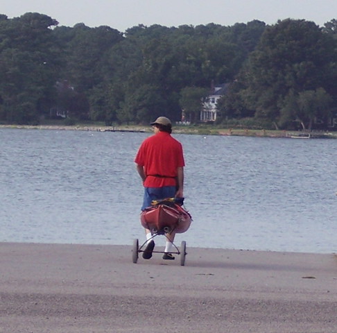
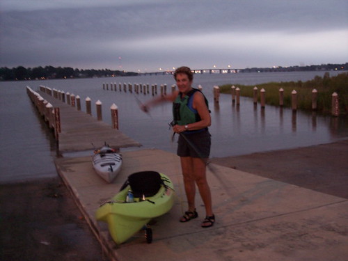
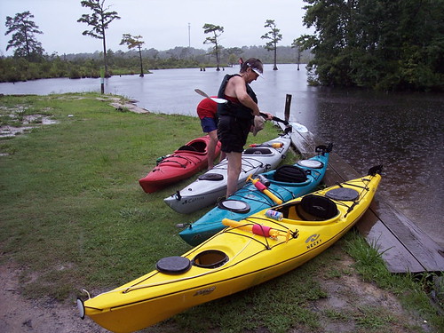
West Neck Creek- 7/31/05
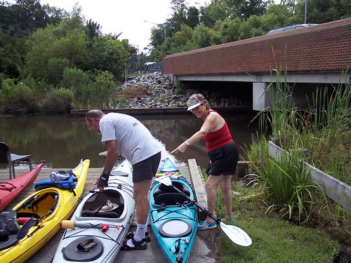
This was the second leg of our tour of the Virginia Beach Scenic Waterway, Covering West Neck Creek from the West Neck Marina south of Pungo to Doziers Bridge on Princess Anne Road near the Virginia Beach Municipal Center. We actually went backwards, from north to south. We intend to have covered the entire waterway, from Munden park to the Lesner Bridge, before the end of the season.
There is a nice dock at the Dozier's Bridge site- a great place to put in. Parking is available, but pay close attention to the no parking signs. One of the Beach's finest drove down to the dock hoping to write a parking ticket or two. Instead, all he could do was wave.
Oh, and Jeanine was helping Jerry find his paddle!
Taking Cover!
Ten minutes into our paddle, it started to rain. Just when we thought it would let up, it rained harder. Just when we thouight it couldn't keep up anymore, it really started pouring! You can see what we were dealing with in the background.
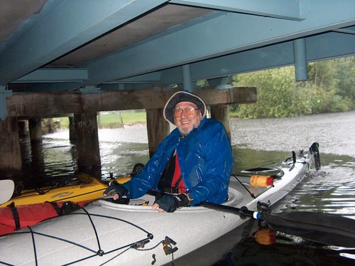
About halfway through the paddle, at the 1:15 mark, we were able to take cover under the Indian River Road bridge for a break from the elements. Those with glasses wiped them off, and those with beverages opened them. Those of us with bailers also bailed our boats of about an inch of accumulated water inside.
Between Princess Anne and Indian River Roads, the paddle goes through a tree-lined channel. Thankfully, someone had been through with a chainsaw sometime after hurricane Isabel, because there were few obstacles. If you have a rudder, you have to take it up every once in a while as you paddle over large floating logs. Chris and Jeanine did a great job of "clearing the way" for Jerry, Jim and Jeff!
A Wet Take Out
You can see how it was still raining at the end of our paddle, but you can see some of the awesome scenery that we went through. It looked great even despite the rain.
We took out at the West Neck Marina's boat ramp, just off of West Neck road in southern Virginia Beach. It cost $2 apeice to park two vehicles at the marina for shuttles. Setting a shuttle is mandatory for one-way paddles, so the paddlers and boats can reunite with their vehicles. We often prefer to carry our boats back to the put-in with our shuttles, so it is important to park vehicles that can carry multiple kayaks.
Too Little Too Late
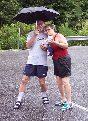
After 3 hours in the pouring rain, Jerry remembered he had an umbrella, and brought it out to protect his soaked self from the drizzle that persisted at the end of the paddle. The drizzle wasn't going to keep us from a little picnic, not after what we'd been through!
All of our paddles are interesting and fun, some more so than others. This paddle was no exception. As long as you didn't mind getting a little wet, this was an awesome paddle!
Subscribe to:
Posts (Atom)
